

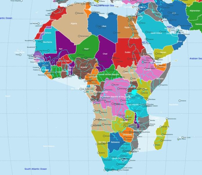
The United Nations General Assembly has adopted a resolution calling for the use of a new world map that more accurately represents the size of Africa and other continents, in a campaign known as the “Correct the Map” initiative.
The resolution, sponsored by Togo and supported by members of the African Union (AU), was approved with the backing of 164 countries, including the United Kingdom and France, while the United States voted against it and six countries abstained.
Although non-binding, the resolution is expected to encourage institutions worldwide to reconsider continued use of the Mercator projection, a map that has been widely used since the 16th century.
Under the Mercator projection, Africa appears comparable in size to Greenland, when in reality the continent is about 14 times larger, with distortion growing more pronounced closer to the poles.
The map was designed in 1569 by Flemish cartographer Gerardus Mercator to assist European navigators, and it preserves direction and shape for navigation at the expense of accurately representing landmass, meaning regions near the equator appear smaller while areas near the poles appear disproportionately large.
Equal Earth Projection Offers A More Accurate Alternative
To address the distortion, cartographers developed the Equal Earth projection in 2018, designed to more accurately represent the relative size of continents.
In February, the AU’s 54 member states adopted the projection, describing it as a map that better represents the true size of all continents, particularly Africa. Togo, which led the UN campaign, argued that correcting the map is about more than cartography, with Togolese Foreign Minister Robert Dussey saying ahead of the vote that “a fair world begins with a fair map.”
France has backed the campaign, with Foreign Minister Jean-Noël Barrot saying his ministry would stop using the Mercator projection, arguing that changing the map would not change the world itself but would correct a representation that has historically distorted it.
Supporters say the issue carries economic and political weight; Lerato Mogoatlhe of Africa No Filter described Africa’s traditional map representation as a narrative problem, while Kenyan geographer Kioko Muendo argued the Mercator projection has helped downplay the continent’s landmass, resources, population and investment potential.
US Pushes Back, Calling The Focus Misplaced
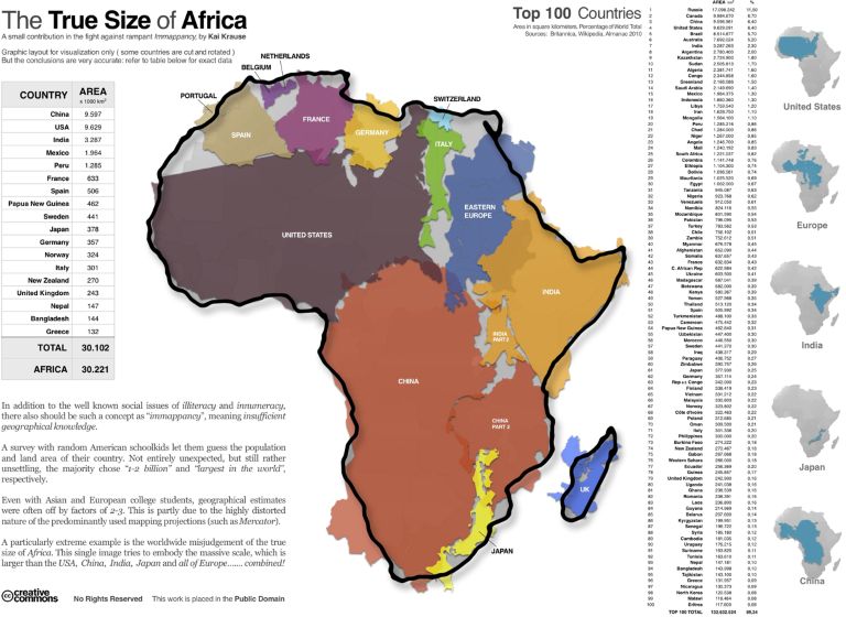
The campaign group #CorrectTheMap has sought to demonstrate Africa’s true scale by pointing out that the continent is large enough to fit the United States, China, India, Japan, Mexico and much of Europe, with land to spare.
Still, the initiative has drawn criticism from the United States, with US representative at the UN, Yaryna Ferencevych, arguing that the General Assembly should focus on issues such as international peace, prosperity and global relations rather than a centuries-old map.
Despite the disagreement, supporters view the change as an important symbolic step toward ensuring the physical scale and significance of Africa are represented accurately on the maps used by institutions worldwide.